I've been mostly on Long Island since the Virginia trip, doing work, saving some money, being somewhat unexciting. However, I have gotten to have some friends from back home or undergrad come by or go into the city to meet up. My friend Mike came down on his way to Maryland in January, and my friend Glen just left, coming out from New Jersey. These good people, along with work, a healthy dose of poker and chess, and an unexpected vacation last week due to snow, have been occupying my time as of late.
However, I do want to relate one travel-related story, from last weekend. My friend Phil and his wife came down from upstate New York to visit both her family in Washington Heights and his sister in Williamsburg. Phil, his wife, his sister, and I met up with Glen in Park Slope for a nice dinner at an Italian place (I don't remember the name, but it was right on 5th Ave somewhere around 2nd or 3rd St). Great homemade pasta and the owners gave us some free port to top off the meal.
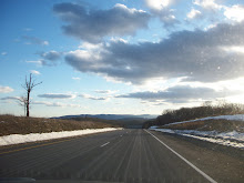
We left to head back to Phil's sister's apartment to walk over to a bar, and we went via the Brooklyn-Queens Expressway. Now, the BQE is one of the most maligned highways in the New York metro area- barely engineered for 1960s traffic, never mind today. I've heard so many horror stories that I personally avoid it unless it's ridiculously late at night and I know there won't be any traffic. It's right up there with the Cross-Bronx expressway. Except....for one spot. Going toward Queens, right after the horrible exit for the Battery Tunnel, you emerge from the endless factory-esque architecture and plop right across the East River from the Financial District. You see how imposing, grand, and beautiful New York really is. As my friend Bobby said the first time we were in the city, there's no conquering it. It's too sprawling, gigantic, yet in its own way as infinitely gorgeous as man can make.
Perhaps the only access we have into comprehending it is through music. And great music since the 19th century is in some sense topographic, in allowing us to take a territory and render its fractal bustle and total confusion into the aesthetic. This doesn't just mean cheap name-checks ("Pasadena, where you at" or "The Little Old Lady from Pasadena" doesn't do much to describe Pasadena, for example)- rather that truly great music splays itself over the land to help you grasp it in some way. So right when we pass the Battery Tunnel exit, the iPod in our car turned to Animal Collective's "My Girls," for my money the only truly great song of 2009. (Not to say that other songs weren't amazing, but as for best song of the last year, the competition wasn't even close.)
There's just something magical about its opening, a cascading fence of motoric synthesized arpeggios. But there's something incredibly fitting about riding on the hideous BQE, motoring at 55-60 alongside untold others barely managing to keep some order without careening into one another. The song keeps building, and then you hit the beautiful view, still motoring along, and the chorus hits. Just listen to the chorus (which doesn't come in until the 3 minute mark!)- the cascading, motoric arpeggios don't stop, but there's a bit more reflection. I had a wonderful moment of looking at New York at night, skyscrapers illluminated through artificial light, riding in a metal box on a massive highway that is a testament to the insanity of modern movement. To quote the end of the chorus, Hooooo!
I then rejoined whatever conversation was going on, and enjoyed the rest of my evening. But for me, car music is not just background- it's an essential part of constructing the landscape. And when you have such beautiful synergy between the land and the sound, between visual and audio, it enhances both. Since my two passions are music and travel, that's the best possible combination.
And for more music about the BQE: http://asthmatickitty.com/the-bqe
Sunday, February 14, 2010
Monday, January 18, 2010
Saturday, January 2nd- In which we make the long haul home

BEGINNING: Williamsburg, VA
END: Long Island via Outerbridge Crossing
STOPPING IN: Jamestown, VA; Rehoboth Beach, DE
ROUTE: VA 31 to VA 199 to I-64 to US 13 to US 113 to DE 24 to DE 1 to Cape May Ferry to US 9 to Garden State Pkwy to NJ 440
Unfortunately, all good trips must come to an end, especially when your traveling partner has work Sunday morning. So we hitched Rita up one last time and drove off from Williamsburg. However, I didn't want to go back the most direct way, which is to hop back on I-95. I've done that ride a whole lot of times already, and since it was our last day, ending the trip with memories of sitting in traffic on the DC beltway was not my cup of tea. Plus, being in Williamsburg opened up a way back almost completely consisting of new roads for me- down to Virginia Beach, up US 13, and to the Garden State Parkway over the Cape May ferry. I managed to convince Bethany to go this way by selling its newness and lack of traffic while softpedaling the approximate time it would take to get there (about 8.5 hours, says Google Maps).
On the way out, we also quickly stopped in Jamestown to see if there was anything to quickly view. We got there around 8:30, noticed that the only things to see were behind a Visitor's Center which wasn't open and charged money for admission, and turned around. We did go to the ruins of a Glasshouse, the foundation of a 1608 building set right on the water. We also, according to Bethany, saw where Captain John Smith fell in love with Pocahontas at about five different locations. It was pretty, even if we mostly struck out in the attractions department.
We then headed west into the Hampton Roads area on I-64 to get to the Chesapeake Bay Bridge-Tunnel. Bridge-tunnels are pretty unique- there are eight in the world, and the only three in the US are all in Eastern Virginia. So on the way to the Chesapeake Bay Bridge-Tunnel, we got the Hampton Roads Bridge-Tunnel. This was fascinating to drive on- it feels as if you're driving on the water, and ahead of you it seems like the road disappears and you go under into a tunnel. However, with the Hampton Roads Bridge-Tunnel, you always see land ahead of you. Not so with the Chesapeake Bay bridge.
 We exited I-64 for US 13 and headed onto the Chesapeake Bay Bridge-Tunnel. The bridge is about 23 miles long, and after the first couple of miles, you stop seeing any land whatsoever. Here you feel not just like you're over a river, but driving on the ocean, where your scenery is the occasional naval boat. A picture of the "scenery" about 15 miles in is on the left. The road had a gentle right-ward bend, and twice disappeared into the water down into the tunnel. I very much enjoy driving on roads that are also engineering marvels (see Skyline Drive earlier in this trip, or previously going on US 1 or through the Eisenhower Tunnel on I-70), and I thoroughly enjoyed being on this impressive road.
  We finally made it to the other side, stopping at an overlook which was freezing and windy, and then traveled the long haul through the Delmarva Peninsula. This part of Virginia was a lot longer than I anticipated, with about 80 miles until the Maryland border, but it was a very easy ride- no traffic, only an occasional traffic light, just a lot of land with not a whole lot on it. It was very much stress-free, which is more than you can say for I-95. Once we got to Maryland, I took the fork for US 113, effectively deciding that we were going over the Cape May ferry rather than up to the NJ Turnpike. In preparation for possibly going this way back, I knew the ferry schedule (it's pretty annoying to get to a ferry and then find out the next one is in an hour). We meandered through middle of nowhere Maryland and Delaware before ending up at the Rehoboth Mall outlets area. Once we found out we were only 10 minutes away from the ferry terminal at that point and had over an hour, we took advantage of the tax-free shopping for a bit. We hightailed it to the ferry to make the 2:45.
The ferry...well, I'm sure it's a fine ferry normally, but we got a day with a wind advisory, notice that the trip would take longer than normal, and warning to always hold the railings if you had to move around. We got one and a half hours of pure rocking. I'm used to the Long Island Sound ferries, which don't really go over exposed seas. This ferry crosses over 17 miles at the mouth of the Delaware River, making for some rocky seas. I've never seen Bethany so focused on a card game (in order to trick herself into not being seasick). Hell, I even felt a bit seasick, and I'm from Cape Cod! After one last jerk at the ferry dock threatened our innards, we eagerly got the hell off of the ferry. It was nice to try it once, but we decided this was probably our last trip on the Cape May-Lewes Ferry.
The rest of our trip was a slow realization that we were getting back into the New York metro area. The bottom of the Garden State Parkway was alternately beautiful (views to the right of beach spits surrounded by marsh and ocean) and annoying (really? traffic lights?). We eventually got back into the city, made it through (Bethany was at the wheel, making her first trek across the city), and were welcomed by roads barely plowed from the night before. We made it back, thoroughly exhausted, and with a mix of happiness to be back and sadness that the trip was over.
************************************
It's been now just over two weeks since we returned to Long Island. Bethany is home in Michigan for a few more days, and I've been teaching and writing grant proposals, which explains the delay in getting the whole trip up. It's been fun to document the trip (though it is easier to do it right after, when the iron is hot- see my previous posts for smoother, more intimate memories). Part of me wishes the trip could have been longer, but it was a wonderful length. There was a good balance of driving and being in places, we had a week jam-packed with new experiences and new places with great memories. And, most importantly, I had good company. It's wonderful having a very easy-going driving and riding partner who is really gung-ho, positive, and goes along with my crazy schemes.
So, where next? For a while, nowhere. I've consigned myself to working my butt off for the next two months here on Long Island. March and April are lining up to be chock-full of travel and excitement, though. And, of course, I'll still be checking in here from time to time. However, it is a nice day above freezing, and so I'm off on a nice bike ride.
Saturday, January 9, 2010
Thursday, December 31st-Saturday, January 1st: In which the Williamsburg time-space continuum has a 4-minute rupture
(In the interest of posting and getting this trip up as soon as possible, I'll post the Williamsburg days together.)
At last, we made it to the raison d'etre of the trip: Williamsburg, VA for First Night. Why here for this holiday? Well, Bethany and I had wanted to spend it together, which did unfortunately mean no party in Somerville preceded by dinner with a massive pitcher of Shipyard Ale (my 2-3 previous New Years locations). Bethany first wanted to do Times Square, but after we learned we had to get there at 9 in the morning and wear a diaper if we actually wanted to save our spot, I looked for other options. I had wanted to go to Williamsburg because I figured it would be quite fun, and I had only been there once, when I was 1. We checked out First Night Williamsburg, and it seemed like a much better option. Absolutely craptons of concerts? Check. Baroque music and random guys playing folk music? Check. Being able to move from place to place? Check. Being somewhere new? Check. Alcohol? No....but it's a college town with a few bars. On the negative side, New York was probably aware of when midnight was. Stay tuned.
Anyway, given that we'd be up very late, Bethany and I lazed about for the morning, rolling out and walking to a nice local breakfast joint where very large people ordered their "usuals." There was a nice, nearly deaf 90-something man sitting in back of us treating a middle-aged woman to lunch (daughter? niece? business partner in black market organ dealings?). After our breakfast, which was our first non-Clif bar-and-cookie breakfast on the trip, we went back to our hotel, gathered our stuff, and went to our one definitely scheduled part of the day- a 1 PM appointment at the Williamsburg Salt Spa on the other side of Colonial Williamsburg. Salt spa? Well, we weren't sure if Berkeley Springs was going to work out because one of their main buildings was closed, and I had wanted to get Bethany something spa-like to help counteract her workaholicism. While doing research on Williamsburg, I discovered the salt spa, which is apparently the only one on the East Coast and something I had never heard of that sounded interesting. So I figured why not and made the reservation, and kept it even though we did Berkeley Springs as well. It wasn't too expensive anyway (about $25 per, if I remember.)
 The salt spa was really a room with ridiculous amounts of salt in it- over 15 tons of salt in the walls, on the ceiling, and on the ground. You sat in the room for 45 minutes and breathed in the air, and it's supposedly as good as sitting by the seashore for three days or something like that. It's really meant for allergies and respiratory ailments, but it's also chilling out for an hour with running fountains in a giant room made out of salt with lots of middle-aged women on break from lunch. Bet you haven't done that recently. It was pretty cool- the chairs were comfortable, the fountains and music created a lovely ambiance, and, well, there was lots of salt. The lights were pretty cool as well, and we decided to get some candle holders since candles look sweet when refracted through the reddish-orange salt blocks.
 We decided to actually head into Williamsburg, stopping by William and Mary to pick up our tickets for First Night. Not knowing what to do, we went to the Visitor Center, where we figured that was where to pick up tickets to go into the houses. Thankfully, Bethany had been here before and knew the setup- I had absolutely no clue. Anyway, we got to the Visitor Center and, after a bit of stewing about the price of the tickets (over $40 apiece!), we got them, picked up a couple of maps and hopped on a bus into town. It was around 3:30 when we got to the Governor's Palace stop, so we didn't have much time before things closed at 5. We hit the Governor's Palace, some of the grounds behind it (including a maze and garden), the cook's barn to the side, and made it to the courthouse for a few minutes. The Governor's Palace was a nice half-hour tour, and the others were more poke-your-head-in-and-see stuff. Luckily, our tickets were for two days, and they were open on New Years Day, so we weren't totally shut out.
After the courthouse closed at 5, we disappointedly saw that nothing was open except for the Public Hospital and the Museum, which were open until 7. The Public Hospital was a museum for the town insane asylum, and was about as creepy as one would imagine a museum dedicated to archaic medical practices would be. The other museum was ok- had some neat old coins and some authentic 18th-century keyboard instruments, which was neat to see. Overall, though, we were more interested in the period acting and historical exhibits than museum exhibits, and so we cut out. We decided to see if we could get into a tavern for dinner, but found out reservations were required, so we made the stroll back to William and Mary for First Night at around 7.
First Night was set up quite nicely- there were about 20 different concert halls and set times that performers would come on, so you could plan your trek (or not plan at all!) without staying in one spot. You had a button, and so you could go to any performance you wanted (and you weren't standing pressed with tons of other people!) Most performers played three different sessions spread throughout the night, while a couple only played early. We headed off to see the last show by the Virginia Handbell Consort, because handbell consorts are always pretty neat to see. Their director was quite cloying, but the musicians were excellent- the group had very tight synchronicity and sounded like one giant instrument. Most of the arrangements were kinda schlocky, though there was a good one of the Twelve Days of Christmas which nicely played with how repetitive the piece was.
After dinner, next up was the Hunt Family, who as we found out, were a mom, dad, and seven kids who could play guitar, sing, fiddle, and Irish step-dance! Bethany and I made pleasant small talk with the nice people next to us (again, able to talk to people next to us! We're not in Long Island anymore), and we got some tips for who to see over the rest of the evening. The group started late, but they did put on a really good show. They were listed as "Irish," but most of it was some cross of Eileen Ivers-ish arrangements with some step dance and occasional U2-like composition. The songs were meh, but the showmanship and talent of the family was top-notch. I also enjoyed watching the parents and making mental comparisons with the Jackson family (who was having fun? which parent was sacrificing their kids happiness for ever more fame? which child was really angry about performing and was gonna go to school to become an accountant and sever all ties? My answers for these questions were: the dad and the eldest daughter, the mom, and the youngest who was kinda put in the back and probably told to not make too much noise).
After them was a bit of a whirlwind- we saw in quick succession the Cavalier Consort, a baroque consort that was not particularly exciting (and didn't have two of the three members in the photo on the link!) They had a good recorder player, but they instead went with the violinist who tried hard but wasn't hitting all the notes and the theorboist who was just kinda boring. Seeing bland Baroque music really annoys Bethany, who is all about interesting, slightly wacky Baroque performance, so we left pretty quickly. Bethany then wanted to swing dance, so we went to the Williamsburg Swing Dance Orchestra. I had done some swing dancing a few years ago during undergrad, taking some lessons as part of an ethnography, but had pretty much forgotten. Bethany, determined to get me out on the dance floor, taught me some things so that it looked like I knew what I were doing, and then we cut some rugs, as they say. The band was solid, played the requisite hits ("Begin the Beguine" and "In the Mood", etc.), and did about 6 songs before going on break. We went then to the Hilton Brass Band, a group with rotating members, but the ones who played were impeccable musicians. They did stuff ranging from an arrangement of the Quodlibet from the Goldberg Variations to Sousa knockoffs to modern music. Considering we saw them on their third 45-minute concert, we were most impressed with their stamina and tone. Their performance was enhanced by their venue, a nice intimate Baptist church with excellent acoustics. One door over from them was No Strings Attached, a folk group of well-bearded men from somewhere in the mountains. Any group where half the members play hammer dulcimer, sing songs about avocados, and look like they'd been playing music casually with each other for about 30 years was all right with me, and provided a nice way to end the concert session. (While posting this, I found their website which showed their tweeting links and such. Well, they made a good show of hillbilly folkocity at least!) Bethany and I were most impressed with the musicianship, and enjoyed roving from concert to concert in the 50-degree weather.
The ending ceremony was, ummm, less inspiring. We got there at about 11:45, just in time to hear some old gospel singer with a frog in his throat sorta get through a karaoke version of "God Bless the USA," not exactly one of my favorites. The organizers then realized that it was about 11:50 and they had nothing to do. So, they stalled the audience until 11:56, at which time they apparently decided "Screw it, we're tired, we're dropping the ball and releasing the fireworks!" So they dropped the "ball," a inflatable pineapple (what pineapples have to do with anything is beyond me), with a countdown where each number was interrupted by the crowd saying "Nooooo! What are you doing! Stop!" and then an announcement of "HAPPY NEW YEAR!!!" at 11:56, four minutes early. Well, we were not pleased in the audience. And so instead everyone looked at their cell phones and did a sorta-unofficial countdown to midnight. Bethany and I joked about how everyone in the audience would be cursed to walk 2010 four minutes earlier than everyone else. It made for some good theater, and would make a great movie trailer I think. They also set off fireworks, which was nice except that it was foggy and so all you saw were clouds that kinda changed color sometimes. The fireworks also kept going, for over 15 minutes. We got bored and left. We had a celebratory whiskey at the bar and then trudged back to the Visitor's center, where we were the only car in the parking lot, and made it to bed by 2.
 We rolled out the next day by 11 to go to a service at the Bruton Parish Church, a beautiful old Episcopal Church which was very similar to the Old North Church in Boston, with old plaques, tall pews, and some old tombstones within the church itself. It was a nice, quick service, and we spent the rest of the day going in and out of the different houses, starting at the church and working down Duke of Gloucester. The Magazine was fascinating, an original building that was the storehouse for weaponry with a host who was very knowledgeable about Revolutionary War. We hit some of the craftspeople (millinery, cooper, silversmith) and had lunch at the one tavern which didn't require a reservation, having lovely turkey sandwiches and delicious corn chowder.
 We continued to stroll down the street, stopping into the artisan houses on the way down to the Capitol. We then spent the last couple of hours with three fairly lengthy tours. We toured the Capitol, hearing about its role in fomenting revolutionary ideas and legislative acts and learning how colonial government worked in all its branches. (The picture to the left is in front of the building while waiting for the tour.) We passed through the jail, an original building, and wandered to the coffeehouse. The coffeehouse had by far the most impressive hosts, someone who acted like a loyalist (praising the intelligence of the governor!) and a slave. This helped flesh out the actors, many of whom acted as free, revolutionary whites, a population that would have been in the minority in actual colonial Williamsburg. The slave regaled a story about how the owner would get people into the store by offering a free two-ounce sample of coffee or chocolate, which would be "just enough to make people mad!" Then, to our shock, he led our group down into the basement, where they had free coffee and chocolate! Bethany had the coffee, and I grabbed the chocolate, which was amazing dark hot chocolate. True enough, it was just enough to make us mad and wanting more, but the line to actually buy some was too long, so instead we went to the Randolph House. This tour, which was of an original building, focused on the changes that the revolution had both on the Randolph family and their slaves. It was very interesting to hear the intimate details of what happened to the family members, a prominent colonial family which became less powerful during the years after the revolutionary war. Although these colonial showcases can be critiqued for creating a static view of colonial life, this tour showed the dynamics and complex social cartography of this time period.
It had reached 5, and so we went toward Market Square, where we had a nice romantic dinner to close off the night. We had gotten to see pretty much all of the houses we were interested in, attended some wonderful concerts, got our exercise walking around, and best of all, it seemed like we weren't four minutes off from the rest of the world as we feared. We were both really happy with the decision to come here for a fun, relaxing, intellectually stimulating, and musically splendid New Years. Not going to Times Square was a most excellent decision. I'm pretty sure this won't be the last time we make our way down to Williamsburg.
At last, we made it to the raison d'etre of the trip: Williamsburg, VA for First Night. Why here for this holiday? Well, Bethany and I had wanted to spend it together, which did unfortunately mean no party in Somerville preceded by dinner with a massive pitcher of Shipyard Ale (my 2-3 previous New Years locations). Bethany first wanted to do Times Square, but after we learned we had to get there at 9 in the morning and wear a diaper if we actually wanted to save our spot, I looked for other options. I had wanted to go to Williamsburg because I figured it would be quite fun, and I had only been there once, when I was 1. We checked out First Night Williamsburg, and it seemed like a much better option. Absolutely craptons of concerts? Check. Baroque music and random guys playing folk music? Check. Being able to move from place to place? Check. Being somewhere new? Check. Alcohol? No....but it's a college town with a few bars. On the negative side, New York was probably aware of when midnight was. Stay tuned.
Anyway, given that we'd be up very late, Bethany and I lazed about for the morning, rolling out and walking to a nice local breakfast joint where very large people ordered their "usuals." There was a nice, nearly deaf 90-something man sitting in back of us treating a middle-aged woman to lunch (daughter? niece? business partner in black market organ dealings?). After our breakfast, which was our first non-Clif bar-and-cookie breakfast on the trip, we went back to our hotel, gathered our stuff, and went to our one definitely scheduled part of the day- a 1 PM appointment at the Williamsburg Salt Spa on the other side of Colonial Williamsburg. Salt spa? Well, we weren't sure if Berkeley Springs was going to work out because one of their main buildings was closed, and I had wanted to get Bethany something spa-like to help counteract her workaholicism. While doing research on Williamsburg, I discovered the salt spa, which is apparently the only one on the East Coast and something I had never heard of that sounded interesting. So I figured why not and made the reservation, and kept it even though we did Berkeley Springs as well. It wasn't too expensive anyway (about $25 per, if I remember.)
 The salt spa was really a room with ridiculous amounts of salt in it- over 15 tons of salt in the walls, on the ceiling, and on the ground. You sat in the room for 45 minutes and breathed in the air, and it's supposedly as good as sitting by the seashore for three days or something like that. It's really meant for allergies and respiratory ailments, but it's also chilling out for an hour with running fountains in a giant room made out of salt with lots of middle-aged women on break from lunch. Bet you haven't done that recently. It was pretty cool- the chairs were comfortable, the fountains and music created a lovely ambiance, and, well, there was lots of salt. The lights were pretty cool as well, and we decided to get some candle holders since candles look sweet when refracted through the reddish-orange salt blocks.
  We decided to actually head into Williamsburg, stopping by William and Mary to pick up our tickets for First Night. Not knowing what to do, we went to the Visitor Center, where we figured that was where to pick up tickets to go into the houses. Thankfully, Bethany had been here before and knew the setup- I had absolutely no clue. Anyway, we got to the Visitor Center and, after a bit of stewing about the price of the tickets (over $40 apiece!), we got them, picked up a couple of maps and hopped on a bus into town. It was around 3:30 when we got to the Governor's Palace stop, so we didn't have much time before things closed at 5. We hit the Governor's Palace, some of the grounds behind it (including a maze and garden), the cook's barn to the side, and made it to the courthouse for a few minutes. The Governor's Palace was a nice half-hour tour, and the others were more poke-your-head-in-and-see stuff. Luckily, our tickets were for two days, and they were open on New Years Day, so we weren't totally shut out.
After the courthouse closed at 5, we disappointedly saw that nothing was open except for the Public Hospital and the Museum, which were open until 7. The Public Hospital was a museum for the town insane asylum, and was about as creepy as one would imagine a museum dedicated to archaic medical practices would be. The other museum was ok- had some neat old coins and some authentic 18th-century keyboard instruments, which was neat to see. Overall, though, we were more interested in the period acting and historical exhibits than museum exhibits, and so we cut out. We decided to see if we could get into a tavern for dinner, but found out reservations were required, so we made the stroll back to William and Mary for First Night at around 7.
First Night was set up quite nicely- there were about 20 different concert halls and set times that performers would come on, so you could plan your trek (or not plan at all!) without staying in one spot. You had a button, and so you could go to any performance you wanted (and you weren't standing pressed with tons of other people!) Most performers played three different sessions spread throughout the night, while a couple only played early. We headed off to see the last show by the Virginia Handbell Consort, because handbell consorts are always pretty neat to see. Their director was quite cloying, but the musicians were excellent- the group had very tight synchronicity and sounded like one giant instrument. Most of the arrangements were kinda schlocky, though there was a good one of the Twelve Days of Christmas which nicely played with how repetitive the piece was.
After dinner, next up was the Hunt Family, who as we found out, were a mom, dad, and seven kids who could play guitar, sing, fiddle, and Irish step-dance! Bethany and I made pleasant small talk with the nice people next to us (again, able to talk to people next to us! We're not in Long Island anymore), and we got some tips for who to see over the rest of the evening. The group started late, but they did put on a really good show. They were listed as "Irish," but most of it was some cross of Eileen Ivers-ish arrangements with some step dance and occasional U2-like composition. The songs were meh, but the showmanship and talent of the family was top-notch. I also enjoyed watching the parents and making mental comparisons with the Jackson family (who was having fun? which parent was sacrificing their kids happiness for ever more fame? which child was really angry about performing and was gonna go to school to become an accountant and sever all ties? My answers for these questions were: the dad and the eldest daughter, the mom, and the youngest who was kinda put in the back and probably told to not make too much noise).
After them was a bit of a whirlwind- we saw in quick succession the Cavalier Consort, a baroque consort that was not particularly exciting (and didn't have two of the three members in the photo on the link!) They had a good recorder player, but they instead went with the violinist who tried hard but wasn't hitting all the notes and the theorboist who was just kinda boring. Seeing bland Baroque music really annoys Bethany, who is all about interesting, slightly wacky Baroque performance, so we left pretty quickly. Bethany then wanted to swing dance, so we went to the Williamsburg Swing Dance Orchestra. I had done some swing dancing a few years ago during undergrad, taking some lessons as part of an ethnography, but had pretty much forgotten. Bethany, determined to get me out on the dance floor, taught me some things so that it looked like I knew what I were doing, and then we cut some rugs, as they say. The band was solid, played the requisite hits ("Begin the Beguine" and "In the Mood", etc.), and did about 6 songs before going on break. We went then to the Hilton Brass Band, a group with rotating members, but the ones who played were impeccable musicians. They did stuff ranging from an arrangement of the Quodlibet from the Goldberg Variations to Sousa knockoffs to modern music. Considering we saw them on their third 45-minute concert, we were most impressed with their stamina and tone. Their performance was enhanced by their venue, a nice intimate Baptist church with excellent acoustics. One door over from them was No Strings Attached, a folk group of well-bearded men from somewhere in the mountains. Any group where half the members play hammer dulcimer, sing songs about avocados, and look like they'd been playing music casually with each other for about 30 years was all right with me, and provided a nice way to end the concert session. (While posting this, I found their website which showed their tweeting links and such. Well, they made a good show of hillbilly folkocity at least!) Bethany and I were most impressed with the musicianship, and enjoyed roving from concert to concert in the 50-degree weather.
The ending ceremony was, ummm, less inspiring. We got there at about 11:45, just in time to hear some old gospel singer with a frog in his throat sorta get through a karaoke version of "God Bless the USA," not exactly one of my favorites. The organizers then realized that it was about 11:50 and they had nothing to do. So, they stalled the audience until 11:56, at which time they apparently decided "Screw it, we're tired, we're dropping the ball and releasing the fireworks!" So they dropped the "ball," a inflatable pineapple (what pineapples have to do with anything is beyond me), with a countdown where each number was interrupted by the crowd saying "Nooooo! What are you doing! Stop!" and then an announcement of "HAPPY NEW YEAR!!!" at 11:56, four minutes early. Well, we were not pleased in the audience. And so instead everyone looked at their cell phones and did a sorta-unofficial countdown to midnight. Bethany and I joked about how everyone in the audience would be cursed to walk 2010 four minutes earlier than everyone else. It made for some good theater, and would make a great movie trailer I think. They also set off fireworks, which was nice except that it was foggy and so all you saw were clouds that kinda changed color sometimes. The fireworks also kept going, for over 15 minutes. We got bored and left. We had a celebratory whiskey at the bar and then trudged back to the Visitor's center, where we were the only car in the parking lot, and made it to bed by 2.
 We rolled out the next day by 11 to go to a service at the Bruton Parish Church, a beautiful old Episcopal Church which was very similar to the Old North Church in Boston, with old plaques, tall pews, and some old tombstones within the church itself. It was a nice, quick service, and we spent the rest of the day going in and out of the different houses, starting at the church and working down Duke of Gloucester. The Magazine was fascinating, an original building that was the storehouse for weaponry with a host who was very knowledgeable about Revolutionary War. We hit some of the craftspeople (millinery, cooper, silversmith) and had lunch at the one tavern which didn't require a reservation, having lovely turkey sandwiches and delicious corn chowder.
  We continued to stroll down the street, stopping into the artisan houses on the way down to the Capitol. We then spent the last couple of hours with three fairly lengthy tours. We toured the Capitol, hearing about its role in fomenting revolutionary ideas and legislative acts and learning how colonial government worked in all its branches. (The picture to the left is in front of the building while waiting for the tour.) We passed through the jail, an original building, and wandered to the coffeehouse. The coffeehouse had by far the most impressive hosts, someone who acted like a loyalist (praising the intelligence of the governor!) and a slave. This helped flesh out the actors, many of whom acted as free, revolutionary whites, a population that would have been in the minority in actual colonial Williamsburg. The slave regaled a story about how the owner would get people into the store by offering a free two-ounce sample of coffee or chocolate, which would be "just enough to make people mad!" Then, to our shock, he led our group down into the basement, where they had free coffee and chocolate! Bethany had the coffee, and I grabbed the chocolate, which was amazing dark hot chocolate. True enough, it was just enough to make us mad and wanting more, but the line to actually buy some was too long, so instead we went to the Randolph House. This tour, which was of an original building, focused on the changes that the revolution had both on the Randolph family and their slaves. It was very interesting to hear the intimate details of what happened to the family members, a prominent colonial family which became less powerful during the years after the revolutionary war. Although these colonial showcases can be critiqued for creating a static view of colonial life, this tour showed the dynamics and complex social cartography of this time period.
 It had reached 5, and so we went toward Market Square, where we had a nice romantic dinner to close off the night. We had gotten to see pretty much all of the houses we were interested in, attended some wonderful concerts, got our exercise walking around, and best of all, it seemed like we weren't four minutes off from the rest of the world as we feared. We were both really happy with the decision to come here for a fun, relaxing, intellectually stimulating, and musically splendid New Years. Not going to Times Square was a most excellent decision. I'm pretty sure this won't be the last time we make our way down to Williamsburg.
Friday, January 8, 2010
Wednesday, December 30th (afternoon)- Virginia from above
(For the first part of today/log info, see post below)
When we got food at a Subway in a gas station in Luray, we decided not to eat it there, but instead up on Skyline Drive in an overlook. After all, why not eat where there's a magnificent view? So we went up to Skyline Drive, on a road full of tight, ascending hairpin turns. We finally got up to the top, went through the gate and got the map for Skyline Drive. (I had done research enough to know where it began and ended, but not all the overlooks). The guide asked if we were doing any hiking, hoping that he didn't have to deal with us planning to traipse for days in the snow. We said that we didn't need hiking maps, just driving through sir, and went on our way.
 As soon as you turn onto Skyline Drive at Thornton Gap, you go up and through the Mary's Rock tunnel, which is an interesting way to begin a drive. We made it through and got to the first overlook, the Tunnel Parking Overlook. We got our first view of a Shenandoah overlook- a majestic panorama of mountains which drop to plains beneath. We parked the car along the curb, and Bethany insisted on eating outside (I was being a wimp due to sub-freezing temperatures and my inability to eat food with mittens). We sat on the little rock wall and ate half of our subs (one great thing about eating footlong subs on roadtrips- two small meals spaced out!). If you blow up the picture, you can see that there's a small ridge with some dead grass, then a cliff down the mountain, which then rises to other peaks in the distance. Truly beautiful. Also, truly cold. After eating and snapping some pictures, I was cold, so ran in the car. Bethany, even with worse circulation, was quite fine.
 The next overlook, Hazel Mountain, was even further up, at around 2700 feet (the maps and signs at the overlooks make sure to tell you the elevation, a nice touch). This had a slightly wider ridge where you could go down even closer to the cliff. I went down and posed for the picture. What you can't see is that both my legs are in about a foot of snow. Ay, the price of vanity, but yea, the glory of car heating.
Apparently, along Skyline Drive there are nearly 100 scenic overlooks, almost one a mile. Moreover, as I looked on the map, I noticed that the middle section had by far the highest elevations, with nearly every point between the two gaps over 3,000 feet. I had figured that this section was the easiest to plow, and therefore the blandest; instead, its views were the most majestic, with Old Rag acting as a focal point to the east and the Massanutten Mountains rising past the valley on our west. I was quite impressed with the Shenandoah staff, plowing the most difficult yet most beautiful sections of the park. Of course, this section is probably the most popular, but I was truly impressed.
 We stopped off at a great deal of overlooks along the way, especially early on. The photo to the left is (I think) from the third overlook we stopped at, the Pinnacles Overlook, now 3,320 feet up. Behind us to the right (where the ridge slopes up) is Pinnacle Peak, and to the left would be Old Rag, a peak whose top is apparently one of the most beautiful ascents in the park, and one I hope to do if (as I'm hoping) I'll be spending some time in DC next year. Behind us is a nice informational plaque about Old Rag, very neat, clean, and direct. While at this overlook, we met an older local couple who were trying out the husband's new Christmas present, his badass Canon zoom lens camera thingy. They were taking advantage of the opening and the winter weather to try and snap some pictures of the abundant wildlife in the park, and he nicely took our picture for us with our camera, which was Bethany's Christmas present. Although I like the program I'm in, Long Island is both hectic and kinda ornery, and it was most pleasant to be someplace nice and relaxed.
 Because Skyline Drive is on a mountain ridge, overlooks abound on both sides, to the east and west. The first few we stopped at were all east facing. We took advantage of a few overlooks on the otherside. This picture is from either the Stony Man or Little Stony Man overlook. Whichever overlook it was had a paved area with small rock wall, and then a small plain that ends in a cliff into the valley. Intrepid Bethany walked over the icy snow to the edge, and I snapped her picture. Notice the difference in this view than the previous ones- rather than a view of mountains with plains deep in the background, this shows a rather sudden valley with a seemingly endless river of mountains behind it. Although the camera could not pick it up, we could see Luray and the route we took up through the overlook. Quite fascinating, how below we were enchanted by the beautiful mountains on our sides, and now looking back on whence we came. I think this picture shows the enormity of the landscape and vastness of the hills, something which awes you if you've spent most of your life on sand bars on the Atlantic. Because it's a winter picture and there's no trees, you really see the enormity of pure mineral, pure rock. That's the wonderful thing with these overlooks- each season will have something to offer, whether the verdant blooms of summer, the changing leaves of late fall, or the naked beauty and calm of winter.
By this point, we had gotten to be overlook pros, so we were no longer stopping at every one (and sometimes we needed to be in the car a couple of miles to warm back up). We passed by Skyland and reached the highest point on the drive, almost 3,700 feet up. We decided to stop at Crescent Rock (elevation over 3500), which faces westward. At first it looked like a regular overlook, with a small parking area and a wonderful view. We got out and saw a plaque indicating that there was a path to an even better view about 100 yards to the left off the main parking area. Now, of course, snow covered the ground, but I ran over to the left and saw the short path to a ledge which we could see from the parking lot. Figuring it wasn't too far, we headed over. Poor Bethany had forgotten her boots, so she gingerly stepped through the snow and ice, while I tried to stomp down so she could literally follow in my footsteps. The path had been stamped down- even though the park had been open no more than 48 hours, already people had come up and down. We finally made it to the ledge, and it truly was an awesome sight. Moreover, we were insulated from the road. Now, the only noises we heard despite the long, echoing valley were ourselves and, occasionally, a cheerful cry from a child hiking with his family in the paths below the overlook. We were wonderfully, beautifully alone.

 This view deserves two pictures to show the full breadth of its grandeur. The ledge, called Crescent Rock, protrudes out, allowing multiple different vantage points. The first picture is the view looking left from the rock. The peak to the right of Bethany is Hawksbill Mountain, the highest peak in the park at over 4100 feet. Because it's winter, you really get a sense of the topography of the mountain, which splays down to the valley below. Looking straight, you would see the slopes of Hawksbill and the cliff below coming to a point, then a valley behind. The second photo, taken by Bethany, is looking to the right directly on the rock. Although they kinda look like it, the pictures don't combine to produce a panorama, although the background hill does come off of Hawksbill. The overlook that we are on (the rock is protruding out), combined with Hawksbill, form the top of this northwest-flowing valley which pours out into the other valley behind it. Then, you can see the Mannahasset mountains rising in back.
 The last stop of note is Big Meadows, which as the name implies, is not an overlook but rather an unexpectedly vast plain about 3500 feet up. We parked and saw the plain overrun with deer! We hadn't seen any wildlife yet (which is probably a good thing given the hilly nature of Skyline- no need to stop suddenly for a deer on a steep descent), and Bethany wanted to take a few pictures. Since deer are relatively docile animals, you can walk up fairly close to them. We, and a few other people, got out of the car and walked into the meadows. (Our friends who took our picture earlier rolled up and were perfectly content to use the zoom lens from the warmth of their truck than get out). Off the parking area was a paved path that bisected the over mile-long meadow, leading to a camping area. The deer were concentrated directly to the right, grazing on one of the few areas with relatively exposed grass. Bethany walked toward the herd (I stayed back for most, then came up), getting quite close to the herd and snapping a few pictures of them grazing like this one. It's hard to believe that the Crescent Rock view and the vast plains of Big Meadows are no more than five miles away, which shows the concentrated diversity and natural beauty found in the park.
Having spent about 2-3 hours stopping at various overlooks for about 20 miles, we were content to head out. We stopped at one more a few miles up to have the other half of our subs, then we went toward the south point of our journey. The few miles north of Swift Run gap seem to know that the northbound driver has been satiated with natural wonder, and so it zooms by relatively quickly and unobtrusively (although my brakes might beg to differ). We got to the gap, exited (and saw the barricade with the road sort of plowed on the other side), and began our descent down from the mountains on US 33. I was careful to pump and cool my brakes so that we'd make it down as smoothly as possible. We got some more downward hairpin turns, and eventually made it down the other side. Bethany had fallen asleep, and so I made the decision to stay on US 33 until I saw a sign for I-64, which roughly paralleled the road to the south. Both roads would end up in Richmond, so I figured at some point there would be a way to hop on the interstate. On the map, it showed that US 29 went down, but it doubled back slightly west and went through Charlottesville, and I figured there would be a more direct way. US 33 was a pleasant, divided highway for a while, but after the US 29 intersection it was slow and meandery, feeling more like a state route. We ran into a downtown (Gordonsville), and I hoped that we'd hit a turnoff sometime soon. Fortunately, the other side of town was good ol' US 15 (which we had left in Maryland), with a nice "To I-64" sign. We took a right, and about 12 miles later we reached I-64. Bethany took over, and we did the last two hours to Williamsburg.
We made it to our motel around 7 or so, and were a little creeped out that we were the only guests in our section of the building (it was, after all, a Wednesday night in the offseason at a cheapo motel). However, our room had functioning heat which did not require insulation via comforter, and we were within walking distance of what seemed like a good local breakfast joint, so we were pleased. After unpacking and showering, we decided to go out on the town. Unfortunately, from general relaxing and a little bit of cluelessness about how Williamsburg was laid out, we didn't get into town until after 9, by which time everything was closed. We resigned ourselves to a dinner of Clif bars, but we knew that we'd have good breakfast in the morning. And, AND, most importantly, we wouldn't have to drive out of town.
When we got food at a Subway in a gas station in Luray, we decided not to eat it there, but instead up on Skyline Drive in an overlook. After all, why not eat where there's a magnificent view? So we went up to Skyline Drive, on a road full of tight, ascending hairpin turns. We finally got up to the top, went through the gate and got the map for Skyline Drive. (I had done research enough to know where it began and ended, but not all the overlooks). The guide asked if we were doing any hiking, hoping that he didn't have to deal with us planning to traipse for days in the snow. We said that we didn't need hiking maps, just driving through sir, and went on our way.
 As soon as you turn onto Skyline Drive at Thornton Gap, you go up and through the Mary's Rock tunnel, which is an interesting way to begin a drive. We made it through and got to the first overlook, the Tunnel Parking Overlook. We got our first view of a Shenandoah overlook- a majestic panorama of mountains which drop to plains beneath. We parked the car along the curb, and Bethany insisted on eating outside (I was being a wimp due to sub-freezing temperatures and my inability to eat food with mittens). We sat on the little rock wall and ate half of our subs (one great thing about eating footlong subs on roadtrips- two small meals spaced out!). If you blow up the picture, you can see that there's a small ridge with some dead grass, then a cliff down the mountain, which then rises to other peaks in the distance. Truly beautiful. Also, truly cold. After eating and snapping some pictures, I was cold, so ran in the car. Bethany, even with worse circulation, was quite fine.
 The next overlook, Hazel Mountain, was even further up, at around 2700 feet (the maps and signs at the overlooks make sure to tell you the elevation, a nice touch). This had a slightly wider ridge where you could go down even closer to the cliff. I went down and posed for the picture. What you can't see is that both my legs are in about a foot of snow. Ay, the price of vanity, but yea, the glory of car heating.
Apparently, along Skyline Drive there are nearly 100 scenic overlooks, almost one a mile. Moreover, as I looked on the map, I noticed that the middle section had by far the highest elevations, with nearly every point between the two gaps over 3,000 feet. I had figured that this section was the easiest to plow, and therefore the blandest; instead, its views were the most majestic, with Old Rag acting as a focal point to the east and the Massanutten Mountains rising past the valley on our west. I was quite impressed with the Shenandoah staff, plowing the most difficult yet most beautiful sections of the park. Of course, this section is probably the most popular, but I was truly impressed.
 We stopped off at a great deal of overlooks along the way, especially early on. The photo to the left is (I think) from the third overlook we stopped at, the Pinnacles Overlook, now 3,320 feet up. Behind us to the right (where the ridge slopes up) is Pinnacle Peak, and to the left would be Old Rag, a peak whose top is apparently one of the most beautiful ascents in the park, and one I hope to do if (as I'm hoping) I'll be spending some time in DC next year. Behind us is a nice informational plaque about Old Rag, very neat, clean, and direct. While at this overlook, we met an older local couple who were trying out the husband's new Christmas present, his badass Canon zoom lens camera thingy. They were taking advantage of the opening and the winter weather to try and snap some pictures of the abundant wildlife in the park, and he nicely took our picture for us with our camera, which was Bethany's Christmas present. Although I like the program I'm in, Long Island is both hectic and kinda ornery, and it was most pleasant to be someplace nice and relaxed.
 Because Skyline Drive is on a mountain ridge, overlooks abound on both sides, to the east and west. The first few we stopped at were all east facing. We took advantage of a few overlooks on the otherside. This picture is from either the Stony Man or Little Stony Man overlook. Whichever overlook it was had a paved area with small rock wall, and then a small plain that ends in a cliff into the valley. Intrepid Bethany walked over the icy snow to the edge, and I snapped her picture. Notice the difference in this view than the previous ones- rather than a view of mountains with plains deep in the background, this shows a rather sudden valley with a seemingly endless river of mountains behind it. Although the camera could not pick it up, we could see Luray and the route we took up through the overlook. Quite fascinating, how below we were enchanted by the beautiful mountains on our sides, and now looking back on whence we came. I think this picture shows the enormity of the landscape and vastness of the hills, something which awes you if you've spent most of your life on sand bars on the Atlantic. Because it's a winter picture and there's no trees, you really see the enormity of pure mineral, pure rock. That's the wonderful thing with these overlooks- each season will have something to offer, whether the verdant blooms of summer, the changing leaves of late fall, or the naked beauty and calm of winter.
By this point, we had gotten to be overlook pros, so we were no longer stopping at every one (and sometimes we needed to be in the car a couple of miles to warm back up). We passed by Skyland and reached the highest point on the drive, almost 3,700 feet up. We decided to stop at Crescent Rock (elevation over 3500), which faces westward. At first it looked like a regular overlook, with a small parking area and a wonderful view. We got out and saw a plaque indicating that there was a path to an even better view about 100 yards to the left off the main parking area. Now, of course, snow covered the ground, but I ran over to the left and saw the short path to a ledge which we could see from the parking lot. Figuring it wasn't too far, we headed over. Poor Bethany had forgotten her boots, so she gingerly stepped through the snow and ice, while I tried to stomp down so she could literally follow in my footsteps. The path had been stamped down- even though the park had been open no more than 48 hours, already people had come up and down. We finally made it to the ledge, and it truly was an awesome sight. Moreover, we were insulated from the road. Now, the only noises we heard despite the long, echoing valley were ourselves and, occasionally, a cheerful cry from a child hiking with his family in the paths below the overlook. We were wonderfully, beautifully alone.

 This view deserves two pictures to show the full breadth of its grandeur. The ledge, called Crescent Rock, protrudes out, allowing multiple different vantage points. The first picture is the view looking left from the rock. The peak to the right of Bethany is Hawksbill Mountain, the highest peak in the park at over 4100 feet. Because it's winter, you really get a sense of the topography of the mountain, which splays down to the valley below. Looking straight, you would see the slopes of Hawksbill and the cliff below coming to a point, then a valley behind. The second photo, taken by Bethany, is looking to the right directly on the rock. Although they kinda look like it, the pictures don't combine to produce a panorama, although the background hill does come off of Hawksbill. The overlook that we are on (the rock is protruding out), combined with Hawksbill, form the top of this northwest-flowing valley which pours out into the other valley behind it. Then, you can see the Mannahasset mountains rising in back.
  The last stop of note is Big Meadows, which as the name implies, is not an overlook but rather an unexpectedly vast plain about 3500 feet up. We parked and saw the plain overrun with deer! We hadn't seen any wildlife yet (which is probably a good thing given the hilly nature of Skyline- no need to stop suddenly for a deer on a steep descent), and Bethany wanted to take a few pictures. Since deer are relatively docile animals, you can walk up fairly close to them. We, and a few other people, got out of the car and walked into the meadows. (Our friends who took our picture earlier rolled up and were perfectly content to use the zoom lens from the warmth of their truck than get out). Off the parking area was a paved path that bisected the over mile-long meadow, leading to a camping area. The deer were concentrated directly to the right, grazing on one of the few areas with relatively exposed grass. Bethany walked toward the herd (I stayed back for most, then came up), getting quite close to the herd and snapping a few pictures of them grazing like this one. It's hard to believe that the Crescent Rock view and the vast plains of Big Meadows are no more than five miles away, which shows the concentrated diversity and natural beauty found in the park.
 Having spent about 2-3 hours stopping at various overlooks for about 20 miles, we were content to head out. We stopped at one more a few miles up to have the other half of our subs, then we went toward the south point of our journey. The few miles north of Swift Run gap seem to know that the northbound driver has been satiated with natural wonder, and so it zooms by relatively quickly and unobtrusively (although my brakes might beg to differ). We got to the gap, exited (and saw the barricade with the road sort of plowed on the other side), and began our descent down from the mountains on US 33. I was careful to pump and cool my brakes so that we'd make it down as smoothly as possible. We got some more downward hairpin turns, and eventually made it down the other side. Bethany had fallen asleep, and so I made the decision to stay on US 33 until I saw a sign for I-64, which roughly paralleled the road to the south. Both roads would end up in Richmond, so I figured at some point there would be a way to hop on the interstate. On the map, it showed that US 29 went down, but it doubled back slightly west and went through Charlottesville, and I figured there would be a more direct way. US 33 was a pleasant, divided highway for a while, but after the US 29 intersection it was slow and meandery, feeling more like a state route. We ran into a downtown (Gordonsville), and I hoped that we'd hit a turnoff sometime soon. Fortunately, the other side of town was good ol' US 15 (which we had left in Maryland), with a nice "To I-64" sign. We took a right, and about 12 miles later we reached I-64. Bethany took over, and we did the last two hours to Williamsburg.
We made it to our motel around 7 or so, and were a little creeped out that we were the only guests in our section of the building (it was, after all, a Wednesday night in the offseason at a cheapo motel). However, our room had functioning heat which did not require insulation via comforter, and we were within walking distance of what seemed like a good local breakfast joint, so we were pleased. After unpacking and showering, we decided to go out on the town. Unfortunately, from general relaxing and a little bit of cluelessness about how Williamsburg was laid out, we didn't get into town until after 9, by which time everything was closed. We resigned ourselves to a dinner of Clif bars, but we knew that we'd have good breakfast in the morning. And, AND, most importantly, we wouldn't have to drive out of town.
Wednesday, January 6, 2010
Wednesday, December 30th (morning)- Virginia from below

BEGINNING: Front Royal, VA
END: Williamsburg, VA
STOPPING IN: Luray, VA; Skyline Drive
ROUTE: US 340 to US 211 to Skyline Drive to US 33 to US 15 to I-64 to VA 143
As you probably remember, the weekend before Christmas was a gigantic blizzard for the entire Northeast corridor from Virginia to Massachusetts. Major cities, especially Washington, DC, were almost completely shut down, and it took major efforts to get roads drivable (or, in the case of Long Island, get major roads semi-drivable, and you're on your own on the side roads). Since we would be possibly near the area, I had wanted to drive Skyline Drive, the touring road through Shenandoah National Park. I've already driven on I-81, and it would certainly be more memorable to use this than mere highways, and we had no rush to get to Williamsburg. Given that it's a scenic road on top of mountains which serves no commercial or transport purposes and got over 2 feet of snow dumped on it, it was unsurprisingly closed down during the weekend. It remained closed through Sunday, the last day I had Internet access. However, I saw that there was a phone number which suggested you call before you planned on heading out, and I put that in my cell to try in the morning if the weather cooperated.
Skyline drive is about 100 miles long, and divided into three sections about 35 miles long. The first section begins in Front Royal, less than a mile from the hotel and right next to Skyline Caverns. The second section begins at US 211 near Luray, right by Luray Caverns. Since we planned on going to both of these, I was hoping that one of these two sections would be open for a convenient scenic route (although I would have driven down US 340 to Elkton to get to the third US 33 entrance). Luckily for us, the weather did cooperate, and there was no additional snow. I called when I woke up at around 8, and Skyline Drive was plowed and open for the second section, from Thornton Gap (US 211, mile 31) to Swift Run Gap (US 33, mile 65). We had our route- hit both caverns, go on the drive, and then meander our way down to Williamsburg.

We managed to survive our rather sketchy hotel and get up and out for Skyline Caverns' first tour at 9. (We had gone by the day before since we got to Front Royal at around 5, and saw their hours.) We were the only two people there, so we got a personal tour from our personable tour guide, James. Skyline Caverns was formed by an underground water channel, so it's fairly easily navigable and contains fascinating rock formations and columns. It's not a flashy cavern, but thoroughly enjoyable and made more enjoyable by our tour guide (more about this later). The top picture is of us in the lobby- as you can see, there aren't giant formations- instead, there are subtly beautiful stalactites, stalagmites, and columns, with some lovely wall coloration and stratification from mud buildup.
 By far the most fascinating part of the caverns was the Anthodite room. Anthodites are incredibly rare, small white snowflake-like formations. No one knows how they form, but it's likely their formation requires a vacuum (which the room was before it was discovered). Because they are so brittle, the caverns had put mesh over them and separated them from the rest of the caverns by a door with a stern warning that the formations were Protected By Virginia Law. If you click on the image on the left to enlarge it, you can see these anthodites. This cave houses both the largest anthodite and the largest concentration of them, and seeing these made the caverns worthwhile.
While at Skyline, we mentioned that we were going down to Luray Caverns. Both the tour guide and a manager just kinda rolled their eyes and said it had changed since I had been there last (which was November 2008). I wasn't quite sure why, and given that it was morning, I wasn't really hearing why it was different, and mentally attributed . Regardless, we meandered down US 340. Running between the famed Skyline Drive on its east and the more functional I-81 on its west, the road didn't gather much traffic. However, with the Shenandoah park on our left and the Massanutten Mountains on the right, it was a quietly beautiful highway, not unlike driving US 40 in Colorado (except with more rounded peaks and about 6,000 feet lower). We got to Luray, and hopped over on US 211 to the cavern site. We soon saw the difference- Luray had shifted to a self-guided audio tour rather than individual guided tours. After you paid, you were directed to pick up a headset, which had a number pad. You then went down into the cave, and along the pathway there were 19 "stations" that you typed numbers into that gave information.
I had three major problems with this style. First, it was much more impersonal than the Skyline Caverns. Part of the fun of a guided tour is that the guide injects his or her own spin on the caves. The silly names for formations that have come out of spending too much time looking at them, the random banter, and either the collection of personalities around you or the intimacy of a private tour, all of these were gone and replaced by officially sanctioned dialogue at specific times which came with its own incredibly cheesy music. Second, there were little kids (and adult idiots) who wouldn't know not to touch stuff. Tour guides help maintain the cave's beauty by providing a presence which ensures things aren't touched. Although they are assumedly going off the idea of safety in numbers, I saw a few kids who wouldn't think twice about touching stuff even though doing so is quite dangerous to the delicate cave environs. Nor was I completely convinced the adults would be completely respectful. Third, you were very aware that you were in a commercial enterprise. Part of viewing the magnificence of natural beauty is the idea of exploration, the creation of meaning through spontaneous interaction. I have enough stress and business in my life in impersonal, constructed architecture. I know I am surrounded by innumerable natural beauty, and I want to be free to personally, unhastenedly, and reverently sanctify it, meditate on it, create my own meaning from it. An audio tour with stations insists that visitors get only one meaning from the tour, rather than allowing them, with their tour guide, to form their own opinions of what is noteworthy and beautiful. Given that the Luray Caverns contains some of the most glorious terrestrial beauty I have ever seen, this is a particular shame. It's a bit like putting spotlights in Niagara Falls (which, if you saw the Ken Burns' National Parks documentary, was the strawman for the immoral exploitation of natural wonder). I would rather my experience with nature seem like prayer and meditation than commerce.

Despite my misgivings for how the Luray Caverns conducts their tours, the immense beauty of the caverns cannot be denied. The caverns are almost 450 million years old, and its age has allowed for the creation of a vast array of absolutely gorgeous mineral formations. Simple stalactites and stalagmites seem almost cliche compared with the grandeur of flowstone, massive fallen rocks, and gargantuan columns. There are almost too many fascinating formations to mention, so I'll show pictures of three of them. The first, on the left, is a massive piece of flowstone, thin, striated mineral formations which curve and fold over, looking like large pieces of bacon (on the left) or a folded washcloth (the right). The pieces are probably 12-14 feet from ceiling to tip, and no more than a 1/4 inch thick. The second is a massive column

called the Redwood, and it is certainly the redwood of columns, a massive, sprawling formation that is untold millions of years old. Last, and the reason I had gone there the first time, was the Great Stalacpipe Organ. Given that they are essentially cylinders protruding from the ceiling, stalactites will produce faint pitches if struck with a mallet. In the 1950s, a Pentagon scientist managed to find stalactites whose pitches correspond to a three-octave keyboard, placed rubber mallets (so as not to damage them) on them, placed tiny microphones, and wired them to a keyboard. I encouraged

Bethany to ask if she could play it, since she's an organist. We found out from a guide that it hadn't been played for three years. Because the organ is based on natural stalactites from all over the cave, different notes have different delay times, which means that you would have to significantly renotate a piece to get the pitches to sound in order. As it was, they had a recording of the organ playing "Ein Feste Burg ist Unser Gott," which was barely recognizable (and this is to music majors who have played this melody for classes and congregations!)
There are many other formations, like the Giants Room, the Fried Eggs, and so forth that we didn't document. Needless to say, the Luray Caverns are awe-inspiring. It was fascinating to us how different our cave experiences were. We both felt Luray Caverns was clearly the more beautiful and interesting cave, but Skyline offered the better experience. Basically, I recommend seeing both. After we exited the Luray caverns, we were given tickets to their old vehicle museum. Apparently caves and the requisite geode and gem stores aren't enough for the caverns- Skyline had a maze and some dragon thing which were both closed for the season, and I'm not sure what old cars had to do with caves or anything. But Bethany wanted to poke in, so we did. It was more interesting than I experienced, but it was good for about 10-15 minutes before we were satiated with old cars. We drove into Luray for gas and food, and then brought Rita up the mountainside to get onto Skyline Drive.
Sunday, January 3, 2010
Tuesday, December 29th: In which we relax with lots of (fresh) water

BEGINNING: Gettysburg, PA
END: Front Royal, VA
STOPPING IN: Emmittsburg, MD; Cunningham Falls State Park, MD; Berkeley Springs, WV
ROUTE: US-30 to PA-97 to Gettysburg Auto Road to US-15 to MD-77 to MD-64 to MD-66 to I-70 to US-522 to US-340
(If you want to start from the beginning, go to the next post and read up.)
Planning is a funny thing. It's bad to plan everything along your route, but it's good to do a lot of planning in order to know where things are, what routes are possible, and where to go in order to maximize the possibilities for doing stuff. This day was the least planned, other than our appointment at the Berkeley Springs State Park. It's also the part of the trip that I knew the least about, having only passed through this area on I-81. Because of this, I looked online and on the map route to figure out the best way to go, what else is on that route, and where to end up.
However, to do stuff, well, you have to get up and do it. We were up and out before 8 despite the freezing, freezing cold. We drove through Gettysburg and south to the Gettysburg National Military Park. The closest section to downtown is the National Cemetery, so we went there first. We were, shockingly, the only people who decided on a sub-freezing Tuesday at 8:30 AM to visit the cemetery, so we had it all to ourselves. Like Arlington, it is a very simple yet moving construction. There is a large statue where Lincoln stood, and the semicircle surrounding it are wedges of killed Union soldiers organized by state, with prominent UNKNOWN sections on either edge, impossible to miss (and drastically larger than the others). Although there was snow on the ground, the graves were reverently shoveled off. It also points the dead exactly toward where Lincoln gave his address, giving a fairly complex relationship between leadership and the dead. The other side is a cemetery that is barred off (from our side, at least), and it is surrounded by various statues and graves of other deceased soldiers and veterans.
One criticism is that you become very aware that it was HERE that Lincoln gave the Gettysburg Address. The first monument you see when you walk up the path, which maps out the cemetery and gives the full text of the Gettysburg Address. At this point, the monument's simple white text on black background allows the somber, yet eloquent poetry of the statement to come through. Yet, every single placard that you see paraphrases it until the phrases become cliche. The Gettysburg Address, at least in my opinion, is beautiful because it is short, sweet, and moving. Taking and reposting chunks banalizes, rather than beatifies, it.
We then went to the visitor's center and picked up a map for the Auto Road. The Gettysburg Auto Road maps out a route for autos so you can drive on the various sites of the battlefield. It's also numbered in chronological order so the driver can follow the progression of the battle. The road is in red on the link. You can see that it's quite long, and since we only had maybe an hour, we just went to the section we were near, the southeast quadrant. We went to stops 13 & 14 (Spangler's Spring and Cemetery Hill), and Culp's Hill. The fascinating part of this trip is not only the various plaques that tell you what happened there. Instead, the whole area is littered with old stone statues to mark the many divisions and battalions which fought there. These seem to be placed in the decades right after the war far before the idea of making the area a National Military Park. Thus, not only do you see tons of statues along the route, but also on the many hiking paths. Since it was very cold, we didn't walk far, but we took a small path just off Culp's Hill, and we saw at least 4 or 5 nowhere near where a driver would see it. It makes for a very serious emotional moment knowing that the way you are directed, even through the National Park system, may not accurately reflect the complex cartographies of history.
We then headed south on US 15, crossing into Maryland at Emmittsburg. On the highway, we saw signs for the Elizabeth Ann Seton shrine. Bethany, being Catholic, wanted to see the shrine for the first U.S.-born saint. We got there just before it opened, waited in the car about 10 minutes, and then went into the basilica. It was a lovely church and a simple shrine on the side, with a good visitor's center, a cheesy gift shop, and some nuns trotting about.
 We left and went south on US 15. About 4 miles from where we turn west onto some Maryland state routes to get towards Berkeley Springs was Cunningham Falls State Park. I had noticed it on Google Maps (which is one of many reasons that Google Maps is fantastic) and when I looked it up, I saw that the path to the falls was less than half a mile and handicapped accessible. So even though the ground was snowy and icy, we hiked up to the falls. That's me, and you can see the falls in the background. Considering the last trip Bethany and I took was all outdoors, it was important that we did some hiking even if the weather was not cooperating. This was also the first place we turned on the new camera which was Bethany's Christmas present (so there's pictures here on in!)
  We meandered west on I-70 until we went south on US 522. Maryland is at its thinnest there- the US 522 exit was one mile before I-70 went north into Pennsylvania. We got off the exit, went about a mile south, and were already in West Virginia. Six miles up is Berkeley Springs, and right downtown is the Berkeley Springs State Park. Berkeley Springs has natural hot springs which have been used for time immemorial, and the center square has been a public spa since the town was incorporated in the mid-18th century. Mineral water is pumped into different tubs- George Washington's tub was memorialized, as you can see if you click on the picture to the left. The state park is a spa with mineral baths and massages on what essentially is a village green. Bethany and I scheduled a 15 minute bath, and we were very nicely given almost 40! The water was supposed to be at 102 degrees, and although it was a little colder owing to the fact that we had the first bath after lunch break, the water was clean, pure, and wonderful to soak in. We then had 30-minute Swedish-style massages at 2. Mine was quite nice, especially on my arms and lower legs. Bethany was less pleased with hers (since state park employees are paid by the state, good masseuses are likely going to work in one of the many private spas around), but she does like her massages painful. We then warmed up and lazed out in a coffeehouse next door before getting back on the road.
 We decided to go to Front Royal, about 60 miles straight down US 522. Front Royal was more of a strategic location than a particular destination. It is the top of Skyline Drive, it allows for travel in the Shenandoah Valley to Luray Caverns via US 340, or if the weather was crappy, we could head east on I-66 and get to Williamsburg (where we were due in Wednesday night) in about 3.5 hours. And, as we discovered via billboards on the way down, there were the Skyline Caverns in Front Royal as well. US 522 enters Virginia at about its northernmost point, and rolls along the hills down into Winchester. It's really quite a beautiful ride through forests and hills brushed with snow, and we took some pictures, one of which you can see to the left. We followed 522 through Winchester and made it down to Front Royal. We stayed in a hotel so sketchy, we actually drove to a Papa John's rather than having the pizza delivered. However, it was only about a mile away from the Skyline Caverns, so we sucked it up and fell asleep. However, we may in the future just spend the extra $20 so that we, say, don't have to use the comforter to block the doorway so the 20-degree air doesn't come in. It wasn't an ideal destination, but it set up a lot of possibilities for the next day and allowed us to enjoy our massages, baths, and look at the new pictures.
Monday, December 28th: In which possible stress is averted. Twice!

BEGINNING: Long Island
END: Gettysburg, PA
STOPPED IN: Bethlehem, PA
ROUTE: Outerbridge Crossing to NJ-440 to I-287 to I-78 to I-81 to I-83 to PA-581 to US-15 to US-30
When I got home from the trip, I saw a commercial from Valero that showed people getting ready for their journeys ahead, with everyone giddy at the potential of the road ahead (and of course, really, really excited about buying Valero gasoline). The road is perfect, the weather clear, the possibilities endless. There is little more American (for better and for worse) than this moment, and the anticipation thereof, the largeness and beauty of the land ahead, the seemingly limitless sights to see.
Of course, the first day of road trips are never so smooth, the potentials of the roads never exactly come into fruition. This is especially true when (1) you live on Long Island and have a very large city to drive through before you get anywhere, and (2) you take a car on its maiden voyage. Thus, I've always found the best thing to do on the first day of a road trip is to take it easy and not require a strenuous amount of driving. If you don't have to necessarily be anywhere (i.e. making a reservation somewhere 8 hours down the road), keep things open so you remain stress-free in the inevitably unexpected horrendous Northeast traffic. Stress in road trips (assuming you are smart and go with people you can stand to be in a car with for extended periods of time) is generally a function of being unable to be someplace where you need to be. So, make sure you don't need to be anywhere. Given the first scheduled thing was an appointment in Berkeley Springs, WV (about 7 hours of real driving) at 1:15 on Tuesday, Monday could be spent driving.
To get there, I wanted to go via Gettysburg since I had not been there yet. Gettysburg is about 4.5 hours away, so we left around 10ish to try and make it before it closed while still sleeping in (and hopefully stay somewhere in Maryland). We got to the Belt Parkway past JFK...and then sat. And sat some more. And then found out via 1010 WINS that there was construction about 5 miles ahead that closed one lane. As I've learned by driving around the New York metro area, one minor incident can screw over an entire road. So, for the 5-6 miles that runs through the Gateway swamplands, which should take about 10 minutes tops, we sat for over an hour. And, of course, the cones were being packed up as soon as we passed the construction area. When you sit, you at least want there to be a payoff everyone-squeezing-into-one-lane moment, not a somewhat unexplained gradual speedup. With going through Staten Island and over the Outerbridge Crossing, it took almost three hours to get to New Jersey.
I-287 and I-78 through Jersey was smooth, but there was traffic at the Delaware River bridge. And as we sat, we noticed the car seemed to, well, limp. While I hadn't noticed any issues with the car on my trip back home to Massachusetts, it is a recently purchased used car. Other than being unable to be somewhere where you need to be, car trouble is the other road trip stress. If these two are combined, then it sucks. However, if you have car trouble but nowhere you really need to be, then you can turn those lemons, well, you know the cliche.
Luckily, we were passing by Bethlehem, which I'm familiar with because my brother went to Moravian and one of my friends from undergrad is from Emmaus (a suburb of Allentown). So we went downtown, asked some people for a place that could do tires or alignments, and brought the car to Strauss Auto. They were able to look at it and get it back in a few hours. We asked for a cab and headed down to main street Bethlehem and enjoyed those few hours! I'd been there, but Bethany had not. We walked up Main Street and she looked in some of the shops, we saw Market Street and the big tree at City Hall. As we walked back toward the Main Street area, we saw signs for the Central Moravian Putz. A putz, other than its definition as a schmuck, is a huge, room-sized kresh that is used to tell the story of Christmas. It was recommended to us by one of our friends, and it was freezing, so we decided why not, and we got in just in time for a production. It was a neat putz because almost all the figurines were over 100 years old, although the music was a little cheesy (I know, I study music history, but the angels are males in the first century AD, not women singing in 18th century counterpoint. Just saying). At the end, the auto company called saying a couple tires needed to be replaced, and while they fixed that, we enjoyed a delicious German dinner and homebrews at the Bethlehem Brew Works. Bethany had the Wit, and I had a Red Bock, and both were just delicious. A cab ride back, and we got the car around 7 or 8.
Obviously, we weren't going to see Gettysburg on Monday, which we had known when the car went wobbly. So instead we drove the two-ish hours to Gettysburg, found a hotel, and planned to see it early in the morning since it would only take about 2 hours to get from there to Berkeley Springs. Despite having a ton of traffic and auto problems, we still had fun in Bethlehem and set ourselves up for a good day Tuesday. Now THAT is a first day of a road trip to get excited about.
Subscribe to:
Posts (Atom)